(Extract from: Denman Island Official Community Plan, 2008)
Geological Origins
All exposed bedrock on Denman Island, and also on Hornby Island, is of sedimentary origin and is assigned to the Late Cretaceous period, roughly 85 to 68 million years ago on the geologic time scale. These sediments are part of the Nanaimo Group and were laid down on a much older and deeply eroded basement consisting of volcanic rocks, limestone and granites formed mainly during the Triassic Period, about 150 to 180 million years ago. The basement rocks are part of the microcontinent Wrangellia, which travelled as much as 2000 km before docking against North America prior to the Late Cretaceous. Basement rocks are exposed on Texada Island and the Beaufort Range on Vancouver Island.
Georgia Basin
The sediments of the Nanaimo Group were deposited in Georgia Basin (geological, not modern geographic), which came into being in the Late Cretaceous. The basin was depressed by the load of the tectonically thickened Coast Range belt to the east and by the accumulating load of sediments. The pebbles and cobbles of the conglomerates that are abundant on the Island represent volcanics and limestone of the basement, plus the volcanic cap of the Coast Range granite complex.
Sedimentary Layers
The marvellous shoreline outcrops of Denman Island reveal the basin-filling mechanisms in great detail. The offshore mudstones alternate with thin sandstone beds deposited by violent turbidity currents in gently sloping, deep-water fans. These layers are succeeded by thick beds of conglomerate and sandstone that flowed or slid into deep water down significantly steeper slopes.
Early Sea Creatures
Fossils found in the shales and sandstones now exposed on the Denman Island coastline demonstrate that the Georgia Basin was connected with the world ocean. Collected fossils reveal that the marine environment was inhabited by a variety of creatures, both strange and familiar. Coiled ammonites, their tentacles extended, swam close to the bottom in search of small fish amongst the seaweed. Crabs and lobsters scavenged the bottom around clams, snails, dentalia and small cup corals. Heart urchins furrowed their way through the organic-rich mud, leaving behind characteristic bilobed trails. Fossil teeth demonstrate that the top level predators in this Late Cretaceous environment were pelagic sharks and mosasaurs (sea lizards). Land must have been close to this seaway because fossil driftwood is quite common. Coalified redwood foliage can be found in the central sandstone ridge of the Island.
Denman Emerges
The rocks of both Denman and Hornby islands are gently deformed. They were raised to their present elevation in the early Tertiary Era, about 60 million years ago, as the Pacific ocean floor was driven beneath North America. Their subsequent history has been one of erosion by rainwater runoff and river, marine and glacial processes, through which they have assumed their present form.
Ice Covers Denman
The iceages brought ice west and south from the Cordillera, the mountain chain extending the full length of the western edge of the Americas, with maximum glaciation occurring about 15,000 years ago. Very gradually the ice melted back, beginning in the south. Looking out from Komas Bluffs, one would have seen the retreating ice to the left, noisily calving off icebergs, and elsewhere shining blue-tinted bergs afloat on blue water
Glacial Deposites
By about 10,000 years ago, the continental ice sheet was gone, and Denman Island again was an exposed land mass. The retreating ice left mysterious ‘erratics, which were sometimes referred to as ‘stranger stones. Erratics are big boulders of foreign rock, especially granite, that have either fallen onto or been picked up by glaciers, while they are high in the mountains, and been carried a long distance by the ice. In this case the erratics were carried from the Cordillera on ice that was more than one kilometre thick. Once the ice melted, Denman Island became home to many of these exotic rocks. Sand and gravel were also deposited, as the ice melted back and torrents of meltwater flowed out from under the wilting icefront. Thus originated the ‘Quadra Sands’ which form Komas Bluff, Longbeak Point, Sandy Island and the Seal Islets.
Recolonization
Relatively little time has passed since the glaciers retreated and the climate of the Island warmed. Recolonization by plants and animals occurred gradually, and many modern species that may have inhabited the region prior to glaciation have not returned. At one time Denman Island may have been home to Grizzly bears, porcupines, skunks, and many other small and large mammals, as well as numerous reptiles, amphibians, a host of invertebrates, and plants now restricted to the mainland. Today’s fauna and flora represent the assortment of species that have flown, swum or rafted to the Island, or crossed on dry land that may have connected Tree Island and Comox. Like all small islands, Denman Island is home to fewer species than larger, nearby landmasses.
Evidence of the earliest human activity in the vicinity of Denman Island was found in a midden at Deep Bay, on Vancouver Island, where archaeologists uncovered stone ‘points’ believed to have be used to hunt elk and deer in about 3,000 B.C. Subsequent aboriginal occupation of Denman Island is evident in numerous shell middens found along the coastline, most often where creeks empty into the sea. In addition, cairns, indicating burial sites, on the islets off the northern tip of the Island and petroglyphs on Chrome (or Yellow) Island, as well as ‘earthworks’ or trenches in what is now Boyle Point Park, also suggest that much of Denman Island was familiar territory for native peoples of the area over a considerable period of time.
The Pentlatch People
On the west coast of Denman Island, or Sla-dai-aich (also haytayich), as it was known by its residents, was one of three villages of the Pentlatch people. Massive intricately carved cedar frames, still evident in 1864, suggest it had once been an extensive and grand settlement before the small-pox epidemic of 1862 took a heavy toll. Those who survived the outbreak in the Denman Island village resettled on Vancouver Island in the Pentlatch settlement located at the junction of the Puntledge and Tsolum rivers. Subsequently, however, their numbers continued to diminish and the few survivors amalgamated with the Comox people. Eventually, Pentlatch, the language of the original human inhabitants of Denman Island, slipped into history.
Sighted by Europeans
The first Europeans to record their sighting of the islands presently called ‘Denman’ and ‘Hornby’ were Spanish sailors who identified them as ‘Islas de Lerena’ in honour of the Minister of the Treasury in the Spanish government of 1791. Largely because George Vancouver failed to see these islands when he sailed in the service of Great Britain the following year, they continued to be referred to as the Islands of Lerena for almost 70 years until the Royal Navy surveyor, George Richards, mapped their shorelines in 1860 and renamed them ‘Denman’ and ‘Homby’ after British Naval Officers.
Europeans Arrive
The first non-native to set foot on Denman Island was likely Joseph William McKay, who along with a party of prospectors stopped on Denman Point, site of the village he called ‘Siklaults’, in October of 1852 and purchased a canoe before extending his search for coal to the Puntledge River. In spite of the fact that, in the intervening years, native title to land in the Comox Valley and adjacent areas was not extinguished, resettlement of the Comox Valley began ten years after McKay’s visit and spread to Denman Island twelve years later.
European Settlers
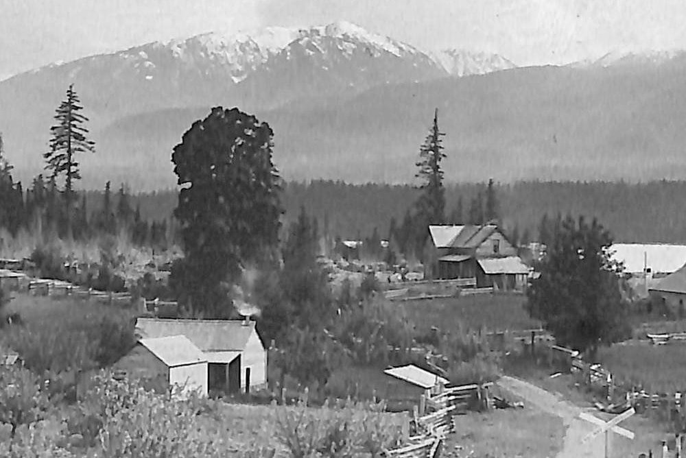
The earliest Europeans attracted to the area in the 1860s were drawn primarily by agricultural opportunities. Open grassy areas in the Comox Valley and on Hornby Island were settled well in advance of heavily treed land on Denman Island, and it was 1874 before the first British immigrants chose the area surrounding the Madigan Marsh to begin farming on this island. [According to Wallace Baikie: “…most of the early settlers came to Denman Island] with the idea of clearing land and making a living off the land. There was little outside money coming in. It was a case of living within one’s means. They cleared land, planted gardens and raised cows, sheep, pigs and horses, worked their land with their teams of horses, planted their crops, made their own butter, and butchered their own beef, pork and mutton…. The people lived off the land, catching fish and shooting deer for their own use. The Islanders raised large families and lived plain lives.” (Wallace Baikie, Rolling With the Times, 1985, p.6)
Slow Growth
Partly because land clearing was a daunting task, the population was slow to grow during the latter part of the Nineteenth Century. Nevertheless, twenty years after the first farm was established, the community totalled about a hundred souls, almost exclusively immigrants from Scotland and England, some after a stint in New Brunswick. Gradually, as the communities of Vancouver Island expanded, a modest demand for lumber developed. Trees, once obstacles to farming on Denman Island, became valued assets, and the second major economic activity of the Island was initiated.
Logging
Although the first logs left Denman Island for a mill in Courtenay in 1878, it was the turn of the century before logging played a central role in the island economy. Henry Bay, an early focal point for logging activity, was a preferred site for several camps over the years, as it provided protective waters where log booms could be formed. In 1925 the Henry Bay Railway Company employed roughly 50 men who intensively logged northern sections of Denman Island. From that time on, logging on the Island was fully integrated into the coastal forest industry, an industry that was characterized by its dependence on the export market.
Consequently the major economic activity on Denman Island became subject to the ‘boom and bust cycles that were played out repeatedly throughout the century and are familiar to most coastal communities in the province. Over the past 100 years, countless individuals, numerous partnerships (frequently involving brothers), several self-described ‘gyppo’ outfits, many companies and even a few international corporations have logged on Denman Island.
Farming
If not the greatest dollar contributor to the local economy, at least the most consistent contribution to the well being of Island residents has been made by farming. From the early days of subsistence agriculture, production attained significant gains early in the last century, when a number of farms produced commodities for export to markets in Cumberland, Courtenay, Nanaimo, Victoria and Vancouver. As early as 1903, Jersey cows were popular on Denman Island, and the rich milk they produced was shipped to the creamery in Comox. Other farm products exported were turnips, potatoes, apples, Christmas trees, corn, lamb, beef, chicken and eggs.
Other Economic Activities
Contributions to the local economy have also been made by numerous enterprises based on resource extraction. The Sandstone Quarry, which formed in 1907, employed as many as 30 men at its peak; a cannery at Deep Bay, which operated between 1917 and 1931, was the source of supplementary income to a number of Denman Island residents familiar with the best local places to catch salmon; and the Northwest Clamshell Plant of New Westminster had a branch operation at Henry Bay in the 1940s, where a few local men crushed shells (from what was likely a midden) for poultry grit. Innumerable saw mills and at least one fish farm have also been active on Denman Island at various times and locations in the past.
Island Access
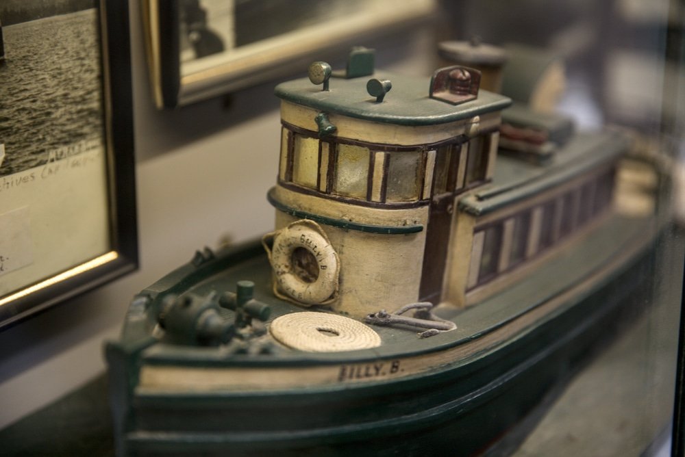
Prior to the inauguration of regular car ferry service from Vancouver Island in 1930, the Island was served by a variety of passenger vessels operating between Vancouver and Comox. With the retirement of the C.P.R. vessel Princess Mary in 1948 and the advent of a car ferry link to Homby Island in 1954, a new era in our history began.
Land Development
In the decades that followed, steadily rising urban prosperity combined with increased automobile accessibility to create a new industry on many islands in the Strait of Georgia. Quite suddenly, ‘recreational property development took its place alongside agriculture and logging as an important landuse as well as a major contributor to local economies. As a result, a number of small lot subdivisions were completed on many of the islands, including Denman Island, before the provincial government introduced a ‘ten-acre freeze’ on subdivision in 1969. The freeze was enacted primarily to protect the rural ambience of the islands, as well as the quality and quantity of potable water available to residents and visitors, both present and future. It was to remain in force until a more effective method for dealing with growth could be devised.
Islands Truest Founded
Between the introduction of the 10-acre freeze and the adoption of the Islands Trust Act in 1974, many of the islands, Denman Island included, experienced unprecedented population growth spurts that were to have far-reaching social and environmental impacts. The ‘back-to-the-land’ movement, which flourished among large segments of North American youth of the late 1960s and early 1970s, together with the influx into Canada of Americans opposed to their government’s military involvement in Vietnam, not only altered the demographics of islands where they formed sizeable minorities but also had profound impacts on the social and political make-up of these communities. Together these movements were harbingers of an era that witnessed an increasing desire on the part of many citizens of developed countries to reduce human impact on the natural environment. The Islands Trust Act of 1974 was, in part, an expression by the government of this emerging sentiment.
Population Growth
Despite the creation of the Islands Trust, the population of the area continued to soar. On Denman Island the population rose by almost 200% in the 22 years following the founding of the Trust, increasing from 350 in 1974 to 1,048 in 1996, while the population across the Trust Area rose by 124%, increasing from 9,933 to 22,261 over the same period. In large part this increase was the consequence of two factors: continued growth of automobile accessibility, specifically, increased ferry service between the lower mainland and Vancouver Island and highway improvements on Vancouver Island; and technological advances, specifically, the fax machine and the internet. These changes made it possible for former urban dwellers to live on Denman Island while earning an income elsewhere and, in addition made it more appealing for those nearing retirement. What were once considered, ‘recreational properties’ became attractive ‘retirement properties.’ As a result, the permanent population of the Island experienced another growth spurt in the late 1980s and early 1990s.
Population Impact
Over the last quarter of the Twentieth Century, a rapidly growing human population has had a number of profound consequences for both the social fabric and the natural environment of Denman Island. Because it forms the transportation link for motor vehicles bound for Hornby Island, Denman Island has borne a particularly heavy burden during this period of growth in demand for recreational and retirement properties on both islands. Furthermore, the population that settled on Denman Island over the course of the last twenty-five years came from relatively diverse backgrounds and moved into a small fairly homogeneous and stable community, largely dependent on farming and logging. As new roads were created, land cleared, wells drilled and houses built to accommodate the influx, ‘land development’ added a third major ‘land use’ burden to the Island. This not only had its own obvious and direct set of impacts on the natural environment but also had the effect of bringing farming, logging and shellfish growing under scrutiny of a new population with different priorities. The result has been that, in recent years, both the scale and harvesting practices of particular logging and shellfish operations have been the source of considerable community discontent.
Modern Economy
The major sources of income for employed Island residents are the service sector, which consists mainly of real estate, local stores and the school, and secondly the transportation sector, which consists of ferries and road maintenance. In recent years, agriculture has shown signs of a renaissance on the island. In addition to several well established apple growers, market gardeners, livestock and hay producers, a number of vineyards are in the early stages of development. Many residents are self employed, earning incomes in a variety of fields, including, the arts, crafts, construction and small manufacturing. Further, a sizeable number of residents are employed in a variety of fields in the Comox Valley and commute daily to Vancouver Island.
Denman Today
While Denman Island’s population grew at a faster rate than that of both the Trust Area and the Province as a whole between 1974 and 1996; population growth rates in the ten years following have not perpetuated that trend. On the contrary, the population growth rate for Denman Island has been decidedly lower than that for the Trust Area and the Province as a whole. Between 1996 and 2006 Denman Island’s population increased by 4.5% [from 1,048 to 1,095] while, over the same period, the growth rate for the Trust Area was 13.9% and for the Province, was 10.4%. The age distribution of Denman Island’s population in 2006 is also noteworthy. As the chart below indicates, between 2001 and 2006, Denman Island’s population aged 60 and over increased by the same margin that the population aged 20 to 39 declined: 2.9%.
Population Distribution by Age (percentage of whole population)
| Age | Denman Island | British Columbia | |
| 2001 | 2006 | 2006 | |
| 0 – 19 | 19.2 | 19.2 | 23.2 |
| 20 – 39 | 14.8 | 11.9 (31.1%<40yrs) | 25.8 (49%<40yrs) |
| 40 – 59 | 37.9 | 37.9 | 31.3 |
| 60 and over | 28.1 | 31.0 (68.9% 40+ yrs) | 19.7 (51% 40+ yrs) |
Denman Island today is a quiet, peaceful place with a largely rural character and significant natural areas. The total population in 2006 was 1,095. As noted above, the demographics of the Island continue to shift as the proportion of the population over the age of sixty increases while that of those below forty declines. This trend is expected to continue for at least a decade as the island attracts “baby boomers” seeking a rural environment for their retirement years. Under current zoning regulations, a population of slightly more than 2,000 is possible.
This number provides a useful reference point for planning for the future and determining an appropriate population size for the Island. Two goals expressed by many islanders are to retain a closely knit community and to remain within the environmental carrying capacity of the island, both of which depend largely on land use and would seem like choices within our control.
The Challenge
History, however, suggests otherwise. Despite their insularity, small island communities have seldom been immune from such seemingly urban phenomena as resource demand fluctuations, or technological change, or population demographic shifts, or even widespread social upheaval. As a consequence land-use trends are usually set in motion by distant events. Denman Island has been no exception: it was resettled, farmed, logged and subdivided in response to forces that originated in a much larger context. To the list of unpredictable urban phenomena that may have profound impacts on island environments and communities must be added the potential impacts of climate change which very likely are to be greater in small island communities than in urban or inland population centres. The Vision Statement and Official Community Plan which follow are, therefore, our best attempts to buffer the delicate natural environment and vital social fabric of this community in advance of an uncertain future, which may well be charted largely by the interaction of remote and complex forces.
The Official Community Plan is the latest of a series of bylaws initiated in 1978. Various revisions and additions since that time have resulted in the current (2008) version of the Plan.